CCS Community Presentation — March 17, 2026
Site Plans from the
District's Own Presentation
All images below are taken directly from Cabarrus County Schools' community presentation on March 17, 2026. We share them here so residents can review the plans for themselves and form their own views.
← Back to The Issue
The site plan shows meaningful engineering work has been done — including 3,450 feet of internal car rider queuing and two stormwater retention ponds to manage drainage. Our questions are not about the quality of the design, but about whether the full costs of building on this particular site — road reconstruction, stream infrastructure, and utilities — are reflected in the publicly stated $50.6 million budget.
The property boundary sits along Sudbury Road on the left and Davidson Highway at the bottom. The wooded ravine is visible across the eastern portion of the site — this is terrain that will require significant grading. The stream runs through the lower-right of the parcel. The building and all site entrances are positioned on the western edge, which is the flattest portion of the property.
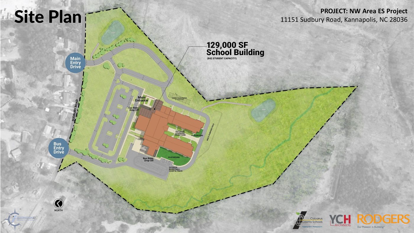
The 129,000 sq ft school building sits in the upper-left — the flattest area of the site. Two stormwater retention ponds (labeled BMP) are designed to manage runoff — evidence that the engineering team has accounted for the drainage challenge. The car rider loop provides 3,450 feet of internal queuing, exceeding NCDOT's requirement by 25%. Both site entrances are on Sudbury Road, which NCDOT has indicated will require reconstruction.
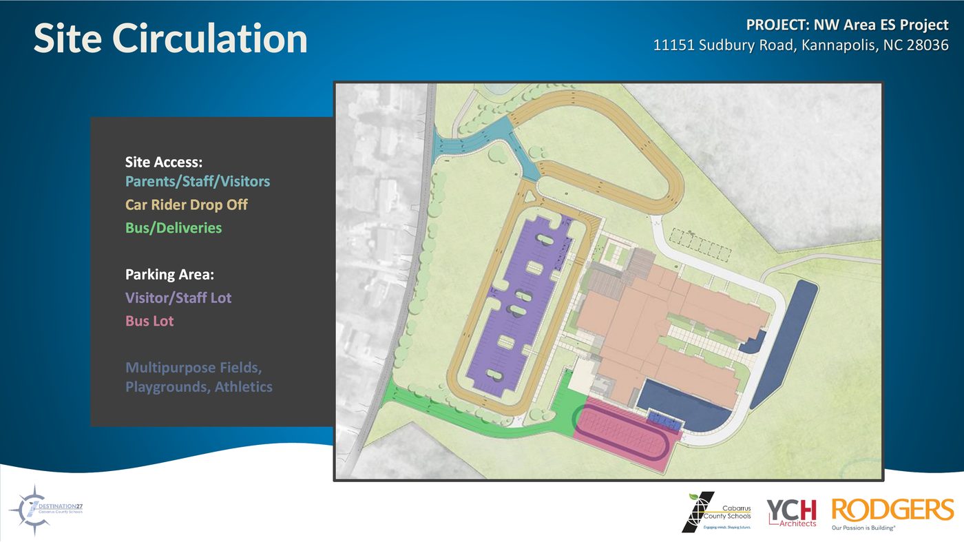
The site design includes separate entrances for car riders and buses, both on Sudbury Road. The internal car rider loop provides 3,450 feet of queuing — 25% more than NCDOT requires. The key open question is what improvements NCDOT will require on Sudbury Road itself, and whether those costs are included in the current budget.
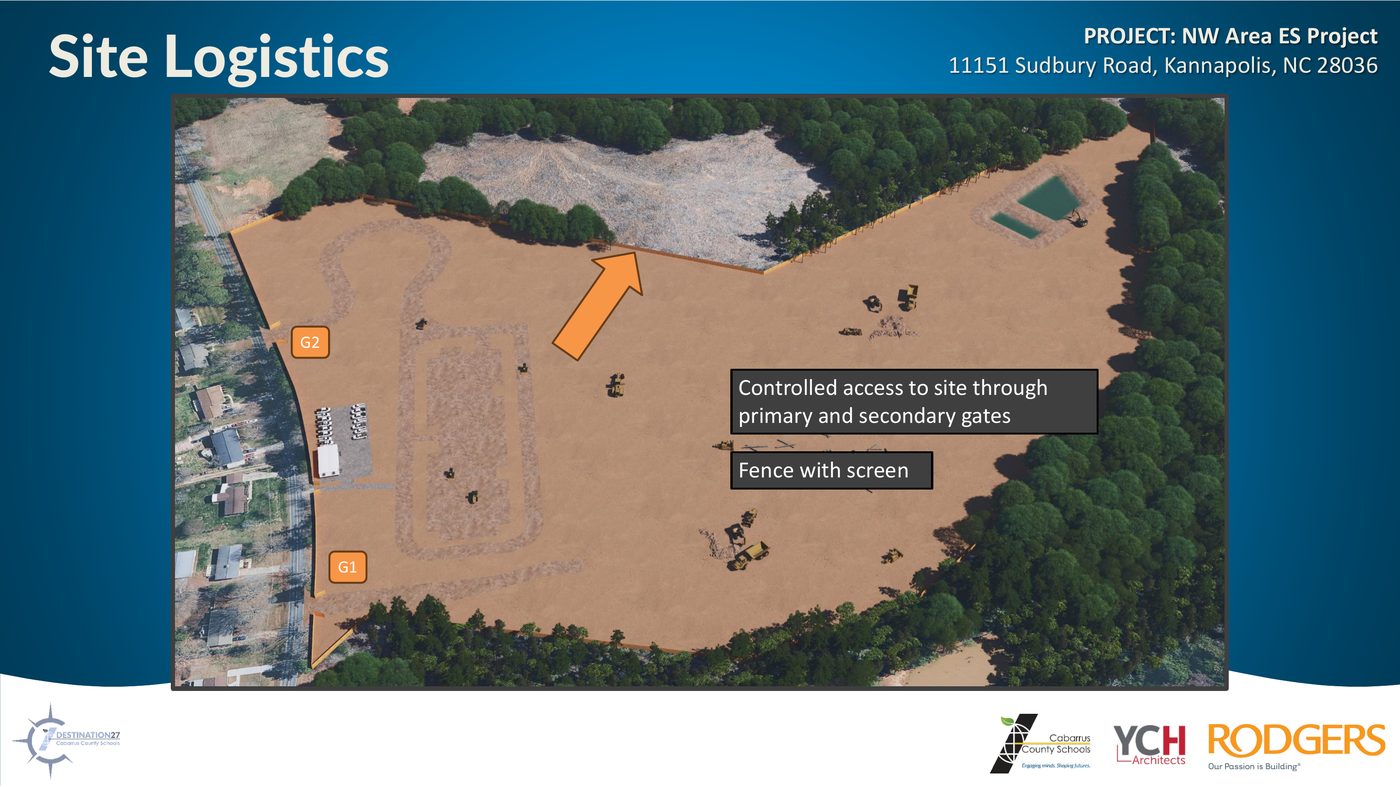
This rendering shows the site during the early construction phase with the wooded area cleared and graded. The scale of earthwork reflects the topographic challenge the district acknowledged during site evaluation. Sitework is scheduled to begin August 24, 2026, with substantial completion in May 2028.
Road Improvement Costs
Both entrances are on Sudbury Road, which NCDOT has indicated needs reconstruction. Final requirements aren't determined until end of April. Are those costs included in the $50.6M budget?
Stream & Environmental Permits
Two stormwater ponds are designed into the site plan, showing the engineers have addressed drainage. We'd like to know the current status of required environmental permits and whether any conditions could affect the schedule.
Complete Budget Picture
The $50.6M figure is publicly stated. We're asking whether road reconstruction, stream mitigation, water, and sewer infrastructure are included in that number or sit outside it.
All images sourced from the CCS NW ES Community Presentation, March 17, 2026.
View the original CCS project page →